It's Saturday and high time for another glimpse of Glacier. The run of the Glacier series is reaching it's end as I leave the park after traveling through the eastern half. However I'll probably have a few installments on here with the scenery east of the park. Much of it is still very significant to Glacier National Park. Some shots are Glacier from a distance on the outside of the park along the highway leading to Canada. I'll likely be writing about those in the next week. Then likely taking the blog into some new grounds, similar outdoor related things no doubt but different local. I can assure you I won't be leaving summer topics alone, I've got plenty more sunny day topics to write about this coming winter.
So where were we? Ah yes, Saint Mary Lake. Only one of the best mountain lakes in North America. Saint Mary Lake is significantly cooler than the earlier visited Lake McDonald. Saint Mary Lake is divided into two portions, upper and lower, today's photos are the upper part.
 |
Looking east at upper Saint Mary Lake.
These photos don't adequately capture the exact hue of the water. Just know that for a mountain lake it's a nice light blue mixed with cobalt blue. |
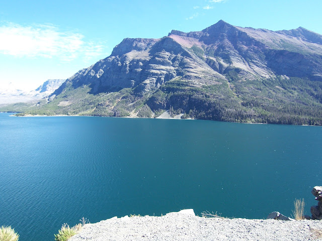 |
Looking south at upper Saint Mary Lake.
Don't get me wrong, I wanted to run out and jump off a cliff ledge and shout "CANNONBALL!" but what you can't see in these frames are the number of tourists snapping photos here beside me. I briefly spent some time talking with some Japanese tourists, even though our different dialects made for some pigeon style awkward conversation (my poor Japanese/their partial English), one thing is universally understood..(I'd be crazy) if I had jumped into the water I'm sure they'd have some interesting stories to tell when they got home. Out of respect for park service (they might frown on that behavior), not having brought my swim trunks, and then learning that water temperatures barely reach 50 degrees Fahrenheit at tops, even for late August I suppose as good as the water looks, it might not feel so stellar. Now see, I guess no foreign tourists get to go home with great stories to tell about crazy Americans.. aw shucks. |
 |
Looking west at upper Saint Mary Lake.
I still can't say I wouldn't totally discount wanting to go swimming in there. The water tone reminds me of one of my all time favorite fantasies of what I'd do if I won the lottery. It's simple: fill a swimming pool with Minute Maid fruit punch, or any other divine nectar of the gods sort of juice. Any flavor, blue berry, water melon, pomegranate, grape, cherry (whatever floats your boat). Then jump in, I know how to swim but in Minute Maid juice I'd likely drown, but hey if I was gonna drown and be happy about it, that would be my preference. |
 |
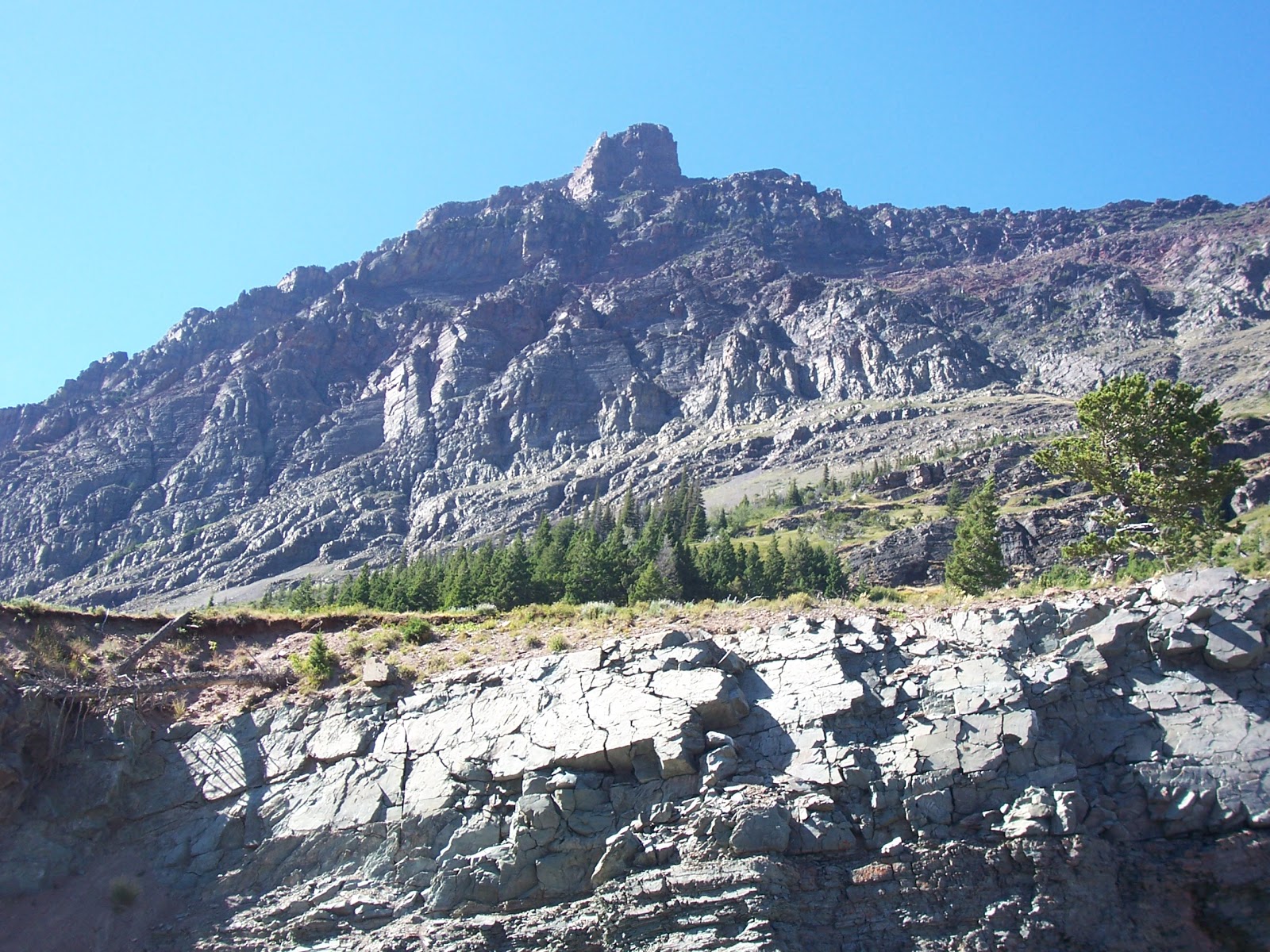
| The rocky facade of Goat Mountain on the north side of upper Saint Mary lake. |
This is considered the bridging area between the prairie and mountain region ecosystems. Not too far east of Saint Mary Lake is an area of land regarded as the meeting point between the Rocky Mountains & The Great Plains. It's a fusion of incredible scenery. The beauty of this northern chunk of Montana is that it lacks much settlement by people. I have lived in a region my whole life where the Rocky Mountains & Great Plains meet yet it's much further south and highly inhabited. In this part of Montana you'll find that it probably looks much the same as it would have when explorers first laid eyes on it, in the days when American tribes still roamed freely, in this region primarily Blackfoot. It's sufficient to proclaim this as one of the last truly pristine regions in the United States largely unaffected by human civilization, just a few countryside places here and there and some friendly faces are to be found.
 |
| The neck of water connecting upper Saint Mary Lake & lower are what's known as the narrows of Saint Mary Lake. In this photo, it's that area just up ahead. It surprised me at first because I thought "That's all?" Then I saw it ran on for some distance past the narrows, it's a big lake. I've seen some bigger but I'll give it it's due, it's an extensive mountain lake. |
 |
| Looking west from near the shore of the narrows. The mountains in the background are the ones I just drove past in previous installments about Glacier National park. |
 |
| I had to pull the car back around on this lonely stretch of road, slow down and capture the water. Once again, what is picked up on the camera is not exactly adequate to portray the true hue of the water here. |
 |
| We have now reached the Camp Rising Sun.. In my head is the guitar rhythm of the "House of the Rising Sun" playing. I don't know why but the whole theme here fits. Driving the "Going To The Sun Road" to the camp of The Rising Sun in a little blue Datsun.. passed an abandoned Sunbeam along the way (true story, before Glacier National Park there was an old Sunbeam Alpine beside the road. I'll save that for a gear head post someday). |
Alright, that was the upper part of the lake. Next installment on Glacier will be the lower half of Saint Mary Lake. Then into the little town of St. Mary's and the roadside scenery of Glacier National Park/Waterton Lakes National Park of Canada from a distance between St. Mary's and the US/Canadian border.


No comments:
Post a Comment